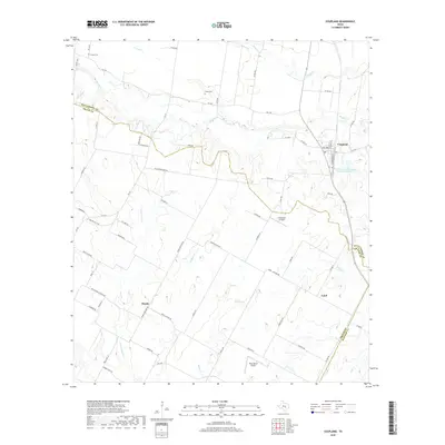
2019 Map of Coupland
USGS Topo · Published 2019About this map
Brushy Cr and its tributaries, including Cottonwood Cr and Willow Cr, define the drainage patterns across this section of Central Texas where Williamson, Travis, and Bastrop counties converge. Small agricultural settlements like Coupland, Manda, and Lund anchor a landscape of farm-to-market roads and rural lanes, reflecting a long history of cattle and cotton farming. Local history is preserved at sites like Kimbro Cem and Avery Cem, while the modern era is marked by small aviation facilities such as Crosswinds Airfield and Skye Dance Airport. The network of roads, including Manda Carlson Rd and Wells School Rd, provides a clear view of the rural infrastructure that has supported these communities for generations. This survey provides a precise record of the terrain and water management features like the Soil Conservation Service Site 32 Reservoir in the late 2010s.
Find a feature on this map
68 named features on this map. Tap any name to fly to it.
Don’t see what you’re looking for? This feature index may not catch every label — zoom into the map to look around manually.
Map Details
Editions of this 2019 Coupland Map
This is the sole edition of this map. No revisions or reprints were ever made.
Other maps of this area

1885 · Taylor
USGS Topo · 1:125,000

1885 · Bastrop
USGS Topo · 1:125,000

1887 · Taylor
USGS Topo · 1:125,000

1893 · Georgetown
USGS Topo · 1:125,000

1893 · Bastrop
USGS Topo · 1:125,000

1894 · Taylor
USGS Topo · 1:125,000

1896 · Austin
USGS Topo · 1:125,000

1897 · Austin
USGS Topo · 1:125,000

1904 · Bastrop
USGS Topo · 1:125,000

1910 · Austin
USGS Topo · 1:125,000