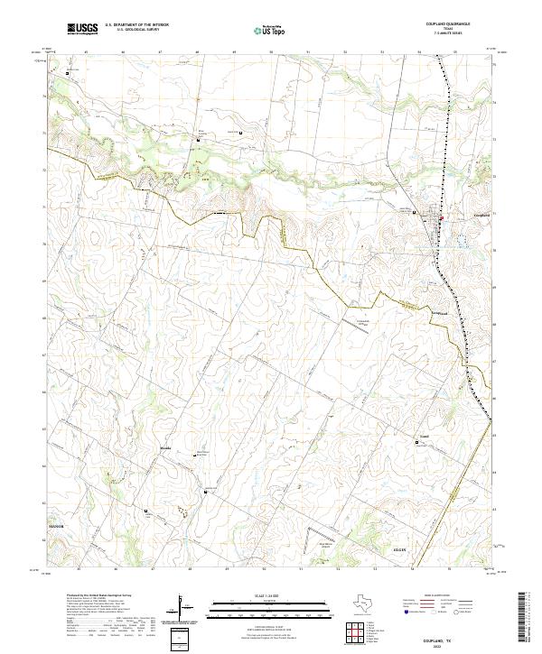
2022 Map of Coupland
USGS Topo · Published 2022About this map
The agrarian landscape of eastern Williamson and Travis counties unfolds across this survey, centered on the community of Coupland. The terrain is defined by the winding course of Brushy Creek and its many tributaries, including Willow Creek and Cottonwood Creek. These watercourses historically dictated the placement of early homesteads and road networks like Lund - Carlson Road. Small rural centers such as Manda and Lund serve as focal points for local history, often anchored by community landmarks like the Wells School Road Cemetery.
Find a feature on this map
77 named features on this map. Tap any name to fly to it.
Don’t see what you’re looking for? This feature index may not catch every label — zoom into the map to look around manually.
Map Details
Editions of this 2022 Coupland Map
This is the sole edition of this map. No revisions or reprints were ever made.
Other maps of this area

1885 · Taylor
USGS Topo · 1:125,000

1885 · Bastrop
USGS Topo · 1:125,000

1887 · Taylor
USGS Topo · 1:125,000

1893 · Georgetown
USGS Topo · 1:125,000

1893 · Bastrop
USGS Topo · 1:125,000

1894 · Taylor
USGS Topo · 1:125,000

1896 · Austin
USGS Topo · 1:125,000

1897 · Austin
USGS Topo · 1:125,000

1904 · Bastrop
USGS Topo · 1:125,000

1910 · Austin
USGS Topo · 1:125,000