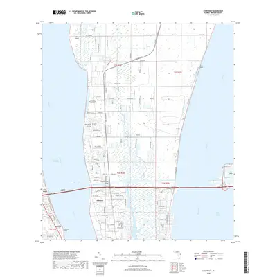
2018 Map of Courtenay
USGS Topo · Published 2018About this map
Merritt Island's northern reaches are captured here between the Indian River and the Banana River, showing a landscape defined by its intricate network of waterways and early coastal settlements. The historic community of Courtenay sits along the western shore, anchored by the Saint Luke's Parish Episcopal Church Cem. To the south, the Canaveral-Barge Canal bisects the island, crossed by the Christa McAuliffe Bridge, a vital link for the region's transport. This map reveals the transition from the marshy environments of Pine Island and Flatboat Creek to the residential growth seen in Indianola and Audubon. The presence of numerous named roads like N Courtenay Pkwy and Chase Hammock Rd illustrates the evolving infrastructure of Brevard County in the early 21st century.
Find a feature on this map
122 named features on this map. Tap any name to fly to it.
Don’t see what you’re looking for? This feature index may not catch every label — zoom into the map to look around manually.
Map Details
Editions of this 2018 Courtenay Map
This is the sole edition of this map. No revisions or reprints were ever made.
Other maps of this area

1949 · Orsino
USGS Topo · 1:24,000

1949 · False Cape
USGS Topo · 1:24,000

1949 · Titusville
USGS Topo · 1:24,000

1949 · Courtenay
USGS Topo · 1:24,000

1949 · Sharpes
USGS Topo · 1:24,000

1949 · Cocoa
USGS Topo · 1:24,000

1949 · Cocoa Beach
USGS Topo · 1:24,000

1951 · False Cape
USGS Topo · 1:24,000

1951 · Cocoa
USGS Topo · 1:24,000

1951 · Courtenay
USGS Topo · 1:24,000