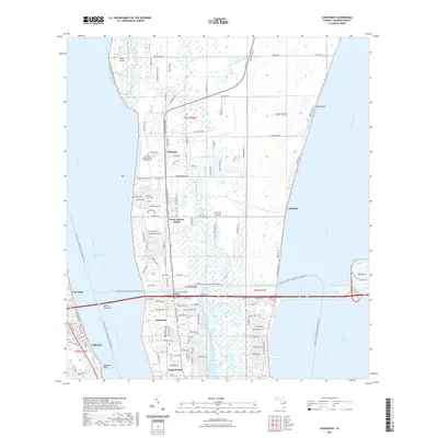
2021 Map of Courtenay
USGS Topo · Published 2021About this map
Merritt Island sits at the heart of this coastal Florida survey, bounded by the Indian River to the west and the Banana River to the east. The landscape is defined by its maritime connections, featuring the transit-heavy Canaveral-Barge Canal and the Intracoastal Waterway. Smaller water bodies like Sykes Creek and Flatboat Creek thread through the island, while the Christa McAuliffe Bridge serves as a modern link over the barge canal.
Find a feature on this map
48 named features on this map. Tap any name to fly to it.
Don’t see what you’re looking for? This feature index may not catch every label — zoom into the map to look around manually.
Map Details
Editions of this 2021 Courtenay Map
This is the sole edition of this map. No revisions or reprints were ever made.
Other maps of this area

1949 · Orsino
USGS Topo · 1:24,000

1949 · False Cape
USGS Topo · 1:24,000

1949 · Titusville
USGS Topo · 1:24,000

1949 · Courtenay
USGS Topo · 1:24,000

1949 · Sharpes
USGS Topo · 1:24,000

1949 · Cocoa
USGS Topo · 1:24,000

1949 · Cocoa Beach
USGS Topo · 1:24,000

1951 · False Cape
USGS Topo · 1:24,000

1951 · Cocoa
USGS Topo · 1:24,000

1951 · Courtenay
USGS Topo · 1:24,000