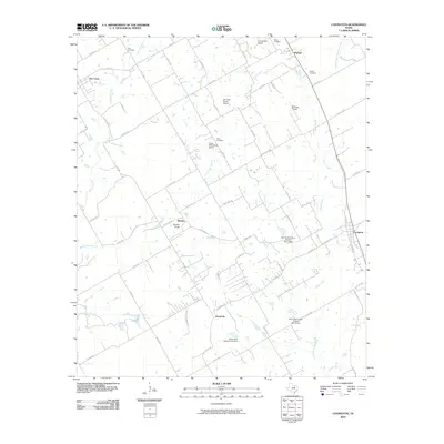
2010 Map of Covington
USGS Topo · Published 2010About this map
Rio Vista and Covington anchor this corner of Johnson County, showing a landscape defined by small-scale aviation and rural ranching at the start of the 21st century. The map reveals a dense network of farm-to-market and county roads connecting disparate settlements like Woodrow, Parker, and Derden. This area is notably characterized by its numerous private landing strips, including Cow Pasture Airport, Sky Vista Ranch Airport, and Birdnest Airport, reflecting the regional reliance on light aircraft for agricultural and personal transport.
Find a feature on this map
66 named features on this map. Tap any name to fly to it.
Don’t see what you’re looking for? This feature index may not catch every label — zoom into the map to look around manually.
Map Details
Editions of this 2010 Covington Map
This is the sole edition of this map. No revisions or reprints were ever made.
Other maps of this area

1891 · Cleburne
USGS Topo · 1:125,000

1894 · Cleburne
USGS Topo · 1:125,000

1924 · Cleburne 3-B
USGS Topo · 1:48,000

1924 · Cleburne 3-C
USGS Topo · 1:48,000

1927 · Blum
USGS Topo · 1:62,500

1954 · Dallas
USGS Topo · 1:250,000

1958 · Dallas
USGS Topo · 1:250,000

1960 · Cleburne East
USGS Topo · 1:24,000
1961 · Cleburne West
USGS Topo · 1:24,000
1961 · Grandview
USGS Topo · 1:24,000