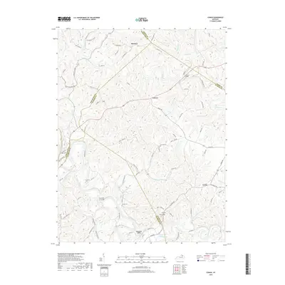
2019 Map of Cowan
USGS Topo · Published 2019About this map
Licking River winds through a landscape of sharp ridges and deep hollows where Robertson, Fleming, Nicholas, and Mason counties converge. This rural region is defined by historic corridors like Old US 68 and the Old Maysville Rd, marking long-established routes through central Kentucky. A notable engineering feature, the Big Tunnel, sits near the southern border by Tunnel Hill, reflecting the area's topographical challenges. Small communities like Cowan, Fairview, and Alhambra anchor the upland plateaus, while cemeteries such as Sunnyside Cem and Herndon Cem provide valuable points of reference for genealogists. The sharp meander known as The Bend of Licking dominates the central river valley, surrounded by numerous named drainages including Mint Cr, Indian Run, and Fleming Creek.
Find a feature on this map
89 named features on this map. Tap any name to fly to it.
Don’t see what you’re looking for? This feature index may not catch every label — zoom into the map to look around manually.
Map Details
Editions of this 2019 Cowan Map
This is the sole edition of this map. No revisions or reprints were ever made.
Other maps of this area

1915 · Maysville
USGS Topo · 1:62,500

1919 · Maysville
USGS Topo · 1:62,500

1952 · Cowan
USGS Topo · 1:24,000

1952 · Sherburne
USGS Topo · 1:24,000

1952 · Elizaville
USGS Topo · 1:24,000

1952 · Sardis
USGS Topo · 1:24,000

1952 · Mount Olivet
USGS Topo · 1:24,000

1952 · Piqua
USGS Topo · 1:24,000
1952 · Mays Lick
USGS Topo · 1:24,000

1953 · Carlisle
USGS Topo · 1:24,000