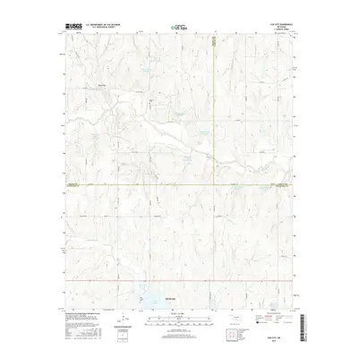
2016 Map of Cox City
USGS Topo · Published 2016About this map
Cox City and the northern outskirts of Duncan anchor this landscape where the boundaries of Grady, Garvin, and Stephens Counties converge. The terrain is defined by a sophisticated water management network, featuring numerous catchment basins such as Rush Creek Site 42 Reservoir and the Rush Creek Site Number 21 Reservoir along the winding course of Rush Creek. In the southern portion of the map, Lake Fuqua serves as a major hydrological landmark near the headwaters of Fish Creek. For those researching local family history, several small burial grounds are preserved across the sections, including Killgore Cem near the center and Tidwell Cem to the east. The rural road grid, including Cox City Road and Ballpark Road, connects these remote homesteads and agricultural tracts in this part of south-central Oklahoma.
Find a feature on this map
51 named features on this map. Tap any name to fly to it.
Don’t see what you’re looking for? This feature index may not catch every label — zoom into the map to look around manually.
Map Details
Editions of this 2016 Cox City Map
This is the sole edition of this map. No revisions or reprints were ever made.
Other maps of this area

1902 · Rush Springs
USGS Topo · 1:125,000

1949 · Rush Springs
USGS Topo · 1:62,500

1950 · Rush Springs
USGS Topo · 1:62,500

1950 · Marlow
USGS Topo · 1:62,500

1951 · Marlow
USGS Topo · 1:62,500

1957 · Ardmore
USGS Topo · 1:250,000

1963 · Ardmore
USGS Topo · 1:250,000

1966 · Lindsay
USGS Topo · 1:24,000

1966 · Lindsay SW
USGS Topo · 1:24,000
1974 · Pernell
USGS Topo · 1:24,000