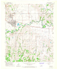
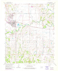
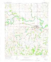
1966 Map of Lindsay
USGS Topo · Published 1967About this map
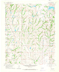
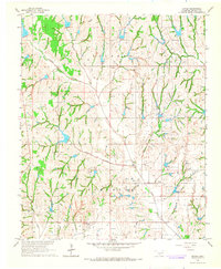
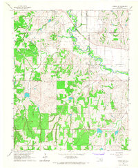
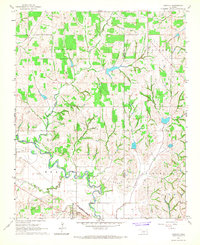
The Golden Trend Oil Field dominates the central landscape of this mid-1960s survey, marking a period of intense industrial activity along the Washita River valley. The town of Lindsay serves as the regional hub, situated at the junction of the Atchison Topeka and Santa Fe railroad and local highways. Evidence of the mid-century petroleum economy is scattered across the township, from a refinery near Bear Creek to numerous unnamed drilling pads and access roads that cut through the undulating terrain south of Erin Springs. Beyond the industrial infrastructure, the map preserves rural landmarks including Green Hill Cemetery and the Hughes Sch, providing a detailed look at Garvin County’s community structure before modern consolidation. The transition from the river bottomlands to the higher ground of Turnbull reflects the varied land use of the era, balancing agriculture with oil extraction.
Find a feature on this map
23 named features on this map. Tap any name to fly to it.
Don’t see what you’re looking for? This feature index may not catch every label — zoom into the map to look around manually.
Map Details
Editions of this 1966 Lindsay Map
2 editions found
Other maps of this area

1898 · Pauls Valley
USGS Topo · 1:125,000

1902 · Pauls Valley
USGS Topo · 1:125,000

1902 · Rush Springs
USGS Topo · 1:125,000

1957 · Ardmore
USGS Topo · 1:250,000

1963 · Ardmore
USGS Topo · 1:250,000
1965 · Maysville
USGS Topo · 1:24,000
1965 · Stealy
USGS Topo · 1:24,000
1966 · Criner
USGS Topo · 1:24,000
1966 · Lindsay SW
USGS Topo · 1:24,000
1966 · Bradley
USGS Topo · 1:24,000