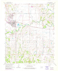
1966 Map of Lindsay
USGS Topo · Published 1980About this map
The Golden Trend Oil Field and Lindsay Oil Field dominate the central landscape of this mid-1960s survey, reflecting the intensive energy production that defined this region of Oklahoma. The city of Lindsay serves as the primary hub, where the Atchison Topeka and Santa Fe railroad line cuts through town near the Lindsay Municipal Landing Field. Industrial infrastructure is prevalent, including a Refinery and a Power Plant situated along the banks of the Washita River.
Find a feature on this map
23 named features on this map. Tap any name to fly to it.
Don’t see what you’re looking for? This feature index may not catch every label — zoom into the map to look around manually.
Map Details
Editions of this 1966 Lindsay Map
2 editions found
Other maps of this area

1898 · Pauls Valley
USGS Topo · 1:125,000

1902 · Pauls Valley
USGS Topo · 1:125,000

1902 · Rush Springs
USGS Topo · 1:125,000

1957 · Ardmore
USGS Topo · 1:250,000

1963 · Ardmore
USGS Topo · 1:250,000

1965 · Maysville
USGS Topo · 1:24,000
1965 · Stealy
USGS Topo · 1:24,000

1966 · Lindsay
USGS Topo · 1:24,000
1966 · Criner
USGS Topo · 1:24,000

1966 · Lindsay SW
USGS Topo · 1:24,000