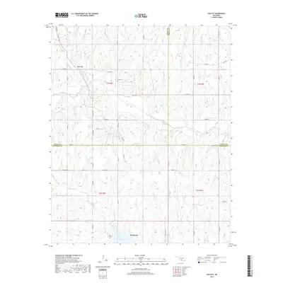
2018 Map of Cox City
USGS Topo · Published 2018About this map
Cox City and the northern outskirts of Duncan define the settlement pattern of this Oklahoma landscape at the intersection of Grady, Stephens, and Garvin counties. The terrain is characterized by a series of significant drainage basins, with Rush Cr and Rounds Cr carving through the northern sections while Black Bear Cr flows toward the southern reservoir of Lake Fuqua. This modern 2018 survey reveals a rural network of roads such as 13 Mile Rd and Ballpark Rd that connect isolated homesteads and family landmarks.
Find a feature on this map
47 named features on this map. Tap any name to fly to it.
Don’t see what you’re looking for? This feature index may not catch every label — zoom into the map to look around manually.
Map Details
Editions of this 2018 Cox City Map
This is the sole edition of this map. No revisions or reprints were ever made.
Other maps of this area

1902 · Rush Springs
USGS Topo · 1:125,000

1949 · Rush Springs
USGS Topo · 1:62,500

1950 · Rush Springs
USGS Topo · 1:62,500

1950 · Marlow
USGS Topo · 1:62,500

1951 · Marlow
USGS Topo · 1:62,500

1957 · Ardmore
USGS Topo · 1:250,000

1963 · Ardmore
USGS Topo · 1:250,000

1966 · Lindsay
USGS Topo · 1:24,000

1966 · Lindsay SW
USGS Topo · 1:24,000
1974 · Pernell
USGS Topo · 1:24,000