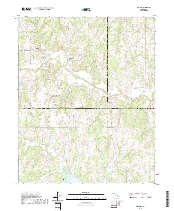
2022 Map of Cox City
USGS Topo · Published 2022About this map
Cox City serves as the central settlement in this rural landscape, situated near the intersection of Cox City Rd and E1580 Rd. The topography is defined by several drainage systems, including the winding course of Rush Creek and its tributary Roundup Creek, which flow toward the southern edge of the quadrangle. In the south, the waters of Lake Fuqua dominate the terrain, creating a distinct hydrological boundary near the junction of several county lines.
Find a feature on this map
47 named features on this map. Tap any name to fly to it.
Don’t see what you’re looking for? This feature index may not catch every label — zoom into the map to look around manually.
Map Details
Editions of this 2022 Cox City Map
This is the sole edition of this map. No revisions or reprints were ever made.
Other maps of this area

1902 · Rush Springs
USGS Topo · 1:125,000

1949 · Rush Springs
USGS Topo · 1:62,500

1950 · Rush Springs
USGS Topo · 1:62,500

1950 · Marlow
USGS Topo · 1:62,500

1951 · Marlow
USGS Topo · 1:62,500

1957 · Ardmore
USGS Topo · 1:250,000

1963 · Ardmore
USGS Topo · 1:250,000

1966 · Lindsay
USGS Topo · 1:24,000

1966 · Lindsay SW
USGS Topo · 1:24,000
1974 · Pernell
USGS Topo · 1:24,000