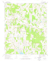
1974 Map of Cox City
USGS Topo · Published 1977About this map
Cox City serves as a focal point for this mid-1970s survey, where the intersection of agriculture and the petroleum industry is clearly visible. The landscape is defined by the extensive Oil Field infrastructure, with numerous Oil Wells and a Gas Well scattered across the townships of Harrison, Lindsay, and Hope. This industrial development is punctuated by small-scale resource extraction at the Gravel Pit and several spillways that manage the local hydrology near the northern reaches of Lake Fuqua.
Find a feature on this map
20 named features on this map. Tap any name to fly to it.
Don’t see what you’re looking for? This feature index may not catch every label — zoom into the map to look around manually.
Map Details
Editions of this 1974 Cox City Map
This is the sole edition of this map. No revisions or reprints were ever made.
Other maps of this area

1902 · Rush Springs
USGS Topo · 1:125,000

1949 · Rush Springs
USGS Topo · 1:62,500

1950 · Rush Springs
USGS Topo · 1:62,500

1950 · Marlow
USGS Topo · 1:62,500

1951 · Marlow
USGS Topo · 1:62,500

1957 · Ardmore
USGS Topo · 1:250,000

1963 · Ardmore
USGS Topo · 1:250,000

1966 · Lindsay
USGS Topo · 1:24,000

1966 · Lindsay SW
USGS Topo · 1:24,000
1974 · Pernell
USGS Topo · 1:24,000