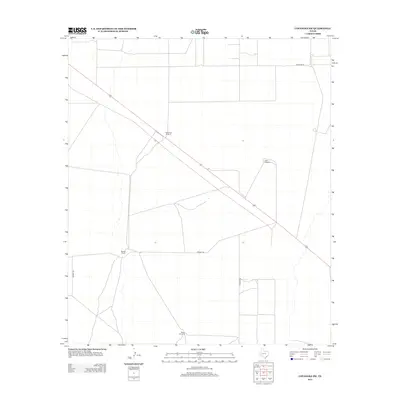
2012 Map of Coyanosa SW
USGS Topo · Published 2012About this map
Mendel Ranch anchors this portion of Pecos County, where the high desert landscape is defined by the vital infrastructure of cattle ranching. Water remains the critical resource of the region, evidenced by the strategic placement of Lawerance Windmill, Ligon Windmill, and Beard Windmill. These named water points serve as historical markers for land ownership and survival in the Trans-Pecos. The network of local thoroughfares, including Mendel Rd and Mcintyre Rd, connects these isolated outposts to the wider region. This 2012 survey captures the persistent rural character of the area, where large-scale ranching operations and private road systems maintain the same footprint they have held for generations in this part of West Texas.
Find a feature on this map
7 named features on this map. Tap any name to fly to it.
Don’t see what you’re looking for? This feature index may not catch every label — zoom into the map to look around manually.
Map Details
Editions of this 2012 Coyanosa SW Map
This is the sole edition of this map. No revisions or reprints were ever made.
Other maps of this area

1929 · Hovey
USGS Topo · 1:125,000

1931 · Barstow
USGS Topo · 1:125,000

1954 · Pecos
USGS Topo · 1:250,000

1954 · Fort Stockton
USGS Topo · 1:250,000

1957 · Pecos
USGS Topo · 1:250,000

1958 · Fort Stockton
USGS Topo · 1:250,000

1970 · Tucker Hill
USGS Topo · 1:24,000

1970 · Belding NW
USGS Topo · 1:24,000
1970 · Barstow 3 SE
USGS Topo · 1:24,000

1970 · Barstow 3 NE
USGS Topo · 1:24,000