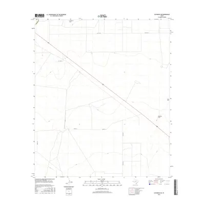
2016 Map of Coyanosa SW
USGS Topo · Published 2016About this map
Hackberry Draw and Coyanosa Draw define the drainage patterns across this arid stretch of West Texas during the mid-2010s. The landscape is characterized by a sparse network of ranch and access roads, including Mcintyre Rd in the north and the perpendicular intersection of Mendel Rd and Kennedy Rd to the south. These features reflect the expansive, open land use typical of Pecos County, where development is largely dictated by seasonal watercourses like Cato Draw. The geometric precision of the road grid suggests a territory managed for resource extraction or large-scale ranching, with few permanent structures or named settlements appearing on the sheet.
Find a feature on this map
8 named features on this map. Tap any name to fly to it.
Don’t see what you’re looking for? This feature index may not catch every label — zoom into the map to look around manually.
Map Details
Editions of this 2016 Coyanosa SW Map
This is the sole edition of this map. No revisions or reprints were ever made.
Other maps of this area

1929 · Hovey
USGS Topo · 1:125,000

1931 · Barstow
USGS Topo · 1:125,000

1954 · Pecos
USGS Topo · 1:250,000

1954 · Fort Stockton
USGS Topo · 1:250,000

1957 · Pecos
USGS Topo · 1:250,000

1958 · Fort Stockton
USGS Topo · 1:250,000

1970 · Tucker Hill
USGS Topo · 1:24,000

1970 · Belding NW
USGS Topo · 1:24,000
1970 · Barstow 3 SE
USGS Topo · 1:24,000

1970 · Barstow 3 NE
USGS Topo · 1:24,000