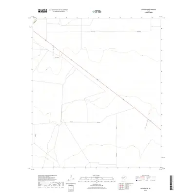
2019 Map of Coyanosa SW
USGS Topo · Published 2019About this map
Hackberry Draw and Coyanosa Draw define the drainage patterns of this arid landscape in West Texas. The terrain is marked by a sparse network of straight-line roads, such as Mcintyre Rd and Mendel Rd, which reflect the vast, organized land tracts typical of Pecos County. A diagonal highway cuts across the grid, intersecting the north-south alignment of Kennedy Rd and providing the primary transit corridor through this remote region. The map illustrates a classic High Plains environment where watercourses are intermittent and the human footprint is defined by large-scale ranching or energy exploration infrastructure, evidenced by the named rural routes and the absence of dense urban centers.
Find a feature on this map
7 named features on this map. Tap any name to fly to it.
Don’t see what you’re looking for? This feature index may not catch every label — zoom into the map to look around manually.
Map Details
Editions of this 2019 Coyanosa SW Map
This is the sole edition of this map. No revisions or reprints were ever made.
Other maps of this area

1929 · Hovey
USGS Topo · 1:125,000

1931 · Barstow
USGS Topo · 1:125,000

1954 · Pecos
USGS Topo · 1:250,000

1954 · Fort Stockton
USGS Topo · 1:250,000

1957 · Pecos
USGS Topo · 1:250,000

1958 · Fort Stockton
USGS Topo · 1:250,000

1970 · Tucker Hill
USGS Topo · 1:24,000

1970 · Belding NW
USGS Topo · 1:24,000
1970 · Barstow 3 SE
USGS Topo · 1:24,000

1970 · Barstow 3 NE
USGS Topo · 1:24,000