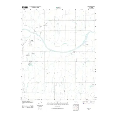
2010 Map of Coyle
USGS Topo · Published 2010About this map
The Cimarron River winds through central Oklahoma in this 2010 study of Logan County, defining a landscape of agricultural section lines and water management infrastructure. The town of Coyle sits on the western edge of the quadrangle, while the smaller settlements of Goodnight and Frost anchor the eastern and southern reaches. Local geography is punctuated by significant water control projects, including the Fitzgerald-Soldier Site 5 Reservoir and various dams along Fitzgerald Creek and Soldier Creek.
Find a feature on this map
41 named features on this map. Tap any name to fly to it.
Don’t see what you’re looking for? This feature index may not catch every label — zoom into the map to look around manually.
Map Details
Editions of this 2010 Coyle Map
This is the sole edition of this map. No revisions or reprints were ever made.
Other maps of this area

1892 · Guthrie
USGS Topo · 1:62,500

1893 · Mulhall
USGS Topo · 1:62,500

1893 · Stillwater
USGS Topo · 1:62,500

1909 · Perkins
USGS Topo · 1:62,500

1954 · Oklahoma City
USGS Topo · 1:250,000

1955 · Enid
USGS Topo · 1:250,000

1957 · Oklahoma City
USGS Topo · 1:250,000

1958 · Enid
USGS Topo · 1:250,000

1963 · Oklahoma City
USGS Topo · 1:250,000
1967 · Stillwater South
USGS Topo · 1:24,000