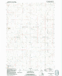
1992 Map of Coyote Butte
USGS Topo · Published 1992About this map
Snake River Birds Of Prey Natural Area dominates this high-desert landscape in Ada County, where the topography is defined by the canyon of the Snake River. This 1992 revision, based on field work and aerial photography from the late 1980s, documents a region primarily dedicated to conservation and military use. The northeastern portion of the quadrangle is occupied by the Idaho National Guard Maneuver and Training Area, bounded by the National Guard Boundary. The most prominent geological landmark is Coyote Butte, which overlooks the northern plains of the Birds of Prey Area. This map is particularly valuable for researchers tracking the institutional land use and environmental designations that shaped the Snake River plateau during the late twentieth century.
Find a feature on this map
6 named features on this map. Tap any name to fly to it.
Don’t see what you’re looking for? This feature index may not catch every label — zoom into the map to look around manually.
Map Details
Editions of this 1992 Coyote Butte Map
This is the sole edition of this map. No revisions or reprints were ever made.
Other maps of this area

1892 · Bisuka
USGS Topo · 1:125,000

1894 · Bisuka
USGS Topo · 1:125,000

1947 · Wild Horse Butte
USGS Topo · 1:24,000

1948 · Big Foot Butte
USGS Topo · 1:24,000

1948 · Wild Horse Butte
USGS Topo · 1:24,000

1948 · Big Foot Butte
USGS Topo · 1:62,500

1948 · Sinker Butte
USGS Topo · 1:24,000

1949 · Sinker Butte
USGS Topo · 1:24,000

1949 · Oreana
USGS Topo · 1:62,500

1955 · Christmas Mtn
USGS Topo · 1:24,000