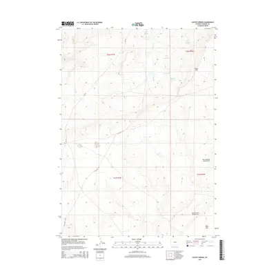
2015 Map of Coyote Springs
USGS Topo · Published 2015About this map
Beaver Rim dominates the eastern horizon of this high-desert landscape in Fremont County, overlooking a network of ephemeral drainages and vital water sources. This 2015 survey details a working landscape where industrial infrastructure meets traditional range land, evidenced by the series of catchments including Day Ore Pad Reservoir, East Reservoir, and Day South Reservoir. These reservoirs, along with eponymous features like Coyote Springs and Mud Springs, define the survival of this arid terrain.
Find a feature on this map
18 named features on this map. Tap any name to fly to it.
Don’t see what you’re looking for? This feature index may not catch every label — zoom into the map to look around manually.
Map Details
Editions of this 2015 Coyote Springs Map
This is the sole edition of this map. No revisions or reprints were ever made.
Other maps of this area

1951 · Stampede Meadow
USGS Topo · 1:24,000

1951 · Black Rock Gap
USGS Topo · 1:24,000

1951 · Lankin Dome
USGS Topo · 1:24,000

1952 · Muskrat Basin
USGS Topo · 1:24,000

1952 · Rongis Reservoir SE
USGS Topo · 1:24,000

1952 · Gas Hills
USGS Topo · 1:24,000

1952 · Puddle Springs
USGS Topo · 1:24,000

1952 · Coyote Springs
USGS Topo · 1:24,000

1952 · Mc Intosh Meadows
USGS Topo · 1:24,000

1955 · Casper
USGS Topo · 1:250,000