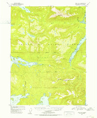
1951 Map of Craig B-3
USGS Topo · Published 1953About this map
Prince of Wales Island is documented here during a period of mid-century industrial and administrative transition. The map highlights the extractive history of the region, featuring the Dawson Mine and the Puyallup Mine (Aban'd), the latter connected to the coast via an Aerial Tramway and a Gaging Station near Hollis. This era of development is juxtaposed with significant jurisdictional boundaries, including the Hydaburg Indian Reservation and a sprawling Cable Protection Area that spans the central terrain between Trocadero Bay and Twelvemile Arm. The presence of a Cable House at the shoreline suggests the importance of maritime communication infrastructure at the time. Glacial geography dominates the landscape, defined by Klawak Lake, the Harris River drainage, and the southern reach toward Soda Bay.
Find a feature on this map
30 named features on this map. Tap any name to fly to it.
Don’t see what you’re looking for? This feature index may not catch every label — zoom into the map to look around manually.
Map Details
Editions of this 1951 Craig B-3 Map
2 editions found

Other maps of this area

1948 · Craig A-4
USGS Topo · 1:63,360

1948 · Craig A-3
USGS Topo · 1:63,360

1948 · Craig A-2
USGS Topo · 1:63,360

1949 · Craig C-2
USGS Topo · 1:63,360

1949 · Craig B-2
USGS Topo · 1:63,360

1949 · Craig B-3
USGS Topo · 1:63,360

1949 · Craig C-3
USGS Topo · 1:63,360

1949 · Craig C-4
USGS Topo · 1:63,360

1949 · Craig B-4
USGS Topo · 1:63,360

1951 · Craig C-3
USGS Topo · 1:63,360