
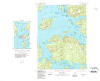
1949 Map of Craig B-4
USGS Topo · Published 1975About this map
Craig and Klawock stand as the primary coastal hubs on the western shores of Prince of Wales Island during this mid-century survey. The maritime character of the region is defined by a dense network of intricate waterways, including San Alberto Bay and the wide reach of Bucareli Bay, which separate the mainland from major landmasses like San Juan Bautista Island and San Fernando Island. Cultural landmarks indicate a landscape transitioning between indigenous heritage and industrial resource extraction, notably marked by the Indian Village (Aband) near Fish Egg Island and the specialized infrastructure at the Waterfall Cannery. Coastal features such as the Aqueduct near Waterfall and the Cem in Craig provide specific points of interest for researchers tracing the development of Southeast Alaska's early twentieth-century fishing and cannery culture.
Find a feature on this map
72 named features on this map. Tap any name to fly to it.
Don’t see what you’re looking for? This feature index may not catch every label — zoom into the map to look around manually.
Map Details
Editions of this 1949 Craig B-4 Map
2 editions found
Other maps of this area

1948 · Craig A-4
USGS Topo · 1:63,360

1948 · Craig B-5
USGS Topo · 1:63,360

1948 · Craig A-5
USGS Topo · 1:63,360

1948 · Craig A-3
USGS Topo · 1:63,360

1949 · Craig B-3
USGS Topo · 1:63,360

1949 · Craig C-3
USGS Topo · 1:63,360

1949 · Craig C-4
USGS Topo · 1:63,360

1951 · Craig C-3
USGS Topo · 1:63,360

1951 · Craig B-4
USGS Topo · 1:63,360

1951 · Craig C-4
USGS Topo · 1:63,360