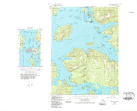
1949 Map of Craig B-4
USGS Topo · Published 1986About this map
Craig serves as a focal point of activity on Prince of Wales Island, situated along the protective waters of Klawock Inlet. The settlement is intricately detailed, showing a Heliport, Athletic Field, and an Indian Village to the north, reflecting the indigenous heritage and post-war infrastructure of this coastal community. The surrounding maritime landscape is defined by the expansive Bucareli Bay and numerous named islands such as San Juan Bautista Island and Fish Egg Island.
Find a feature on this map
73 named features on this map. Tap any name to fly to it.
Don’t see what you’re looking for? This feature index may not catch every label — zoom into the map to look around manually.
Map Details
Editions of this 1949 Craig B-4 Map
2 editions found
Other maps of this area

1948 · Craig A-4
USGS Topo · 1:63,360

1948 · Craig B-5
USGS Topo · 1:63,360

1948 · Craig A-5
USGS Topo · 1:63,360

1948 · Craig A-3
USGS Topo · 1:63,360

1949 · Craig B-3
USGS Topo · 1:63,360

1949 · Craig C-3
USGS Topo · 1:63,360

1949 · Craig C-4
USGS Topo · 1:63,360

1949 · Craig B-4
USGS Topo · 1:63,360

1951 · Craig C-3
USGS Topo · 1:63,360

1951 · Craig B-4
USGS Topo · 1:63,360