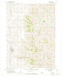
1970 Map of Craig
USGS Topo · Published 1972About this map
Craig serves as the primary hub of this eastern Nebraska landscape, situated near the intersection of several vital waterways and transport lines. The town’s historical footprint is well-defined by the Craig Cem and the tracks of the Chicago and North Western railroad, which cuts a diagonal path through the southeastern terrain. The surrounding countryside is defined by the drainage basins of Bell Creek and Silver Creek, with several smaller tributaries like Mud Creek and Tekamah Creek carving through the agricultural land. Local family and community history is preserved through the locations of rural burying grounds such as Grace Cem and Silver Creek Cem, while a Gaging Station on the southern edge of the survey indicates the importance of water management for the townships of Craig and Summit.
Find a feature on this map
13 named features on this map. Tap any name to fly to it.
Don’t see what you’re looking for? This feature index may not catch every label — zoom into the map to look around manually.
Map Details
Editions of this 1970 Craig Map
2 editions found
Other maps of this area

1955 · Fremont
USGS Topo · 1:250,000

1957 · Fremont
USGS Topo · 1:250,000

1958 · Fremont
USGS Topo · 1:250,000

1966 · Oakland
USGS Topo · 1:24,000

1966 · Lyons
USGS Topo · 1:24,000

1966 · Nickerson NW
USGS Topo · 1:24,000

1970 · Oakland SE
USGS Topo · 1:24,000
1970 · Tekamah NW
USGS Topo · 1:24,000
1970 · Bertha
USGS Topo · 1:24,000

1970 · Herman
USGS Topo · 1:24,000