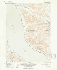
1951 Map of Craig C-1
USGS Topo · Published 1953About this map
Meyers Chuck serves as a primary point of human activity along the northern coastline of the Cleveland Peninsula in this 1951 topographic study. The landscape is defined by the heavy maritime influence of Clarence Strait and Kasaan Bay, where isolated cabins and small settlements dot the timbered shores of the Tongass National Forest. The map documents a significant era of extractive history, specifically noting the decline of regional mining operations.
Find a feature on this map
32 named features on this map. Tap any name to fly to it.
Don’t see what you’re looking for? This feature index may not catch every label — zoom into the map to look around manually.
Map Details
Editions of this 1951 Craig C-1 Map
2 editions found

Other maps of this area

1949 · Craig C-2
USGS Topo · 1:63,360

1949 · Craig D-2
USGS Topo · 1:63,360

1949 · Craig B-2
USGS Topo · 1:63,360

1949 · Ketchikan C-6
USGS Topo · 1:63,360

1949 · Craig B-1
USGS Topo · 1:63,360

1949 · Craig D-1
USGS Topo · 1:63,360

1950 · Craig B-1
USGS Topo · 1:63,360

1950 · Craig C-1
USGS Topo · 1:63,360

1951 · Craig B-2
USGS Topo · 1:63,360

1951 · Craig D-2
USGS Topo · 1:63,360