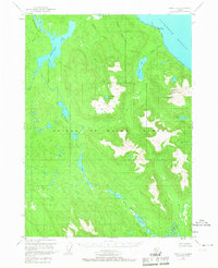
1949 Map of Craig D-3
USGS Topo · Published 1967About this map
Prince of Wales Island dominates this 1940s landscape, characterized by an intricate network of inland waterways and glacial-cut shorelines along the Clarence Strait. The interior is defined by significant freshwater bodies, including the expansive Sweetwater Lake and the connected systems of Thorne Lake and the Thorne River. Higher elevations are marked by landmarks such as Baird Pk, rising above the coastal timberlands of the Tongass National Forest.
Find a feature on this map
19 named features on this map. Tap any name to fly to it.
Don’t see what you’re looking for? This feature index may not catch every label — zoom into the map to look around manually.
Map Details
Editions of this 1949 Craig D-3 Map
3 editions found
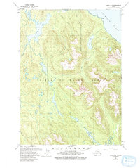
Other maps of this area

1948 · Petersburg A-2
USGS Topo · 1:63,360

1949 · Craig D-3
USGS Topo · 1:63,360

1949 · Craig C-2
USGS Topo · 1:63,360

1949 · Craig D-2
USGS Topo · 1:63,360

1949 · Petersburg A-3
USGS Topo · 1:63,360

1949 · Craig D-4
USGS Topo · 1:63,360

1949 · Petersburg A-4
USGS Topo · 1:63,360

1949 · Craig C-3
USGS Topo · 1:63,360

1949 · Craig C-4
USGS Topo · 1:63,360

1950 · Craig D-3
USGS Topo · 1:63,360