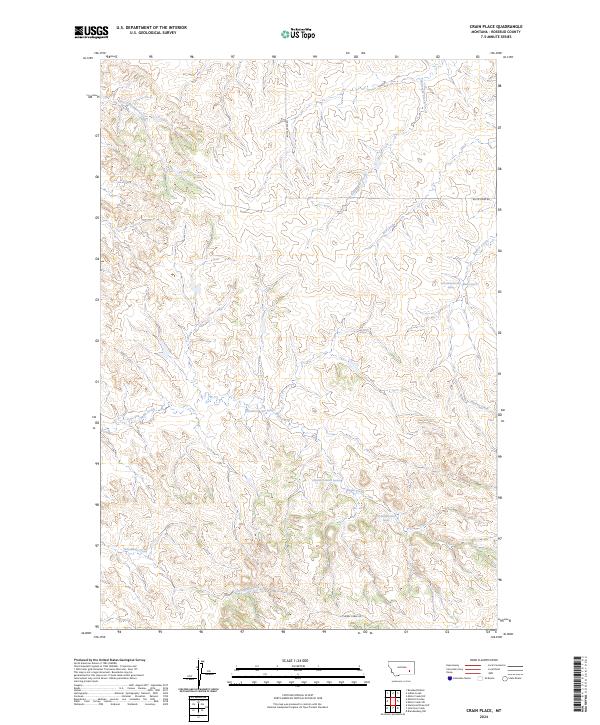
2024 Map of Crain Place
USGS Topo · Published 2024About this map
Goodman Creek and Beaver Creek define the drainage patterns of this Rosebud County landscape, illustrating a remote stretch of eastern Montana where water sources are vital landmarks. The topography is shaped by a network of seasonal coulees and intermittent streams, including Twelvemile Creek and East Cottonwood Creek, which carve through the high plains. Unlike more developed regions, this area is characterized by its reliance on specific water points such as Barrot Spring and various unnamed springs like 03N44E08DCAC01 Spring that anchor the local geography. Surface transportation is limited to established rural routes like Butte Creek Rd and Cherry Creek Rd, which follow the natural contours of the land. The map provides a detailed view of the township and range divisions, showing the survey lines for t4n r44e and t3n r43e that dictate land ownership and cattle grazing boundaries in this open-range country.
Find a feature on this map
17 named features on this map. Tap any name to fly to it.
Don’t see what you’re looking for? This feature index may not catch every label — zoom into the map to look around manually.
Map Details
Editions of this 2024 Crain Place Map
This is the sole edition of this map. No revisions or reprints were ever made.
Other maps of this area

1954 · Hardin
USGS Topo · 1:250,000

1954 · Forsyth
USGS Topo · 1:250,000

1957 · Hardin
USGS Topo · 1:250,000

1957 · Forsyth
USGS Topo · 1:250,000

1958 · Forsyth
USGS Topo · 1:250,000

1958 · Hardin
USGS Topo · 1:250,000
1969 · Miller Creek SW
USGS Topo · 1:24,000
1969 · Miller Creek NW
USGS Topo · 1:24,000
1971 · Brandenberg NW
USGS Topo · 1:24,000

1971 · Hammond Draw NW
USGS Topo · 1:24,000