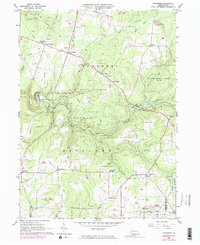
1963 Map of Cranberry
USGS Topo · Published 1983About this map
Oil and gas fields dominate this survey of Venango County, revealing an industrial landscape defined by numerous wells and pumping stations. The central corridor is shaped by the winding course of East Sandy Creek, where the Penn Central railroad tracks follow the water's edge through the expansive State Game Lands No 45. This map captures a period of transition where traditional rural crossroads like Egypt Corners, Barrs Corners, and Nickleville sit alongside modern mid-century additions such as a drive-in theater near the Township Sch.
Find a feature on this map
45 named features on this map. Tap any name to fly to it.
Don’t see what you’re looking for? This feature index may not catch every label — zoom into the map to look around manually.
Map Details
Editions of this 1963 Cranberry Map
Other maps of this area

1907 · Foxburg
USGS Topo · 1:62,500

1908 · Foxburg
USGS Topo · 1:62,500

1909 · Franklin
USGS Topo · 1:62,500

1910 · Hilliards
USGS Topo · 1:62,500

1911 · Franklin
USGS Topo · 1:62,500

1912 · Hilliards
USGS Topo · 1:62,500

1922 · Oil City
USGS Topo · 1:48,000

1924 · Oil City
USGS Topo · 1:62,500

1943 · Oil City
USGS Topo · 1:62,500

1944 · Hilliards
USGS Topo · 1:62,500
Featured Places
- Cranberry Township, PA
- Rockland Township, PA
- Ashland Township, PA
- Richland Township, PA
- Salem Township, PA