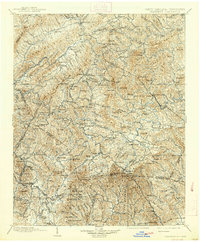
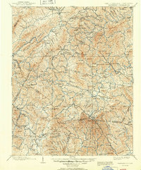
1902 Map of Cranberry
USGS Topo · Published 1938About this map
Grandfather Mountain and the high ridges of the Blue Ridge anchor this survey of the High Country as it appeared at the turn of the century. The map documents a transition from isolated valley settlements like Valle Crucis and Vaughtsville to a developing mountain economy connected by early infrastructure. The East Tennessee and Western North Carolina RR snakes through the western terrain, while the Yonah Lossee Road provides a rare formal route across the high peaks near Blowing Rock. Small crossroads like Shoun Crossroads and Sugar Grove serve as local hubs, and industry is represented by sites such as Patterson Mill and Shulls Mill. The intricate topography around Mountain City and the headwaters of the Watauga River reveal the complex drainage patterns of the Iron Mountain and Beech Mountain ranges before modern development altered the landscape.
Find a feature on this map
164 named features on this map. Tap any name to fly to it.
Don’t see what you’re looking for? This feature index may not catch every label — zoom into the map to look around manually.
Map Details
Editions of this 1902 Cranberry Map
6 editions found

Other maps of this area

1889 · Wytheville
USGS Topo · 1:125,000

1889 · Wilkesboro
USGS Topo · 1:125,000

1891 · Roan Mountain
USGS Topo · 1:125,000

1891 · Abingdon
USGS Topo · 1:125,000

1891 · Wilkesboro
USGS Topo · 1:125,000

1892 · Wytheville
USGS Topo · 1:125,000

1893 · Cranberry
USGS Topo · 1:125,000

1894 · Roan Mountain
USGS Topo · 1:125,000

1894 · Abingdon
USGS Topo · 1:125,000

1895 · Hickory
USGS Topo · 1:125,000