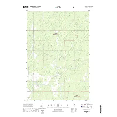
2018 Map of Crandon NE
USGS Topo · Published 2018About this map
The Nicolet National Forest dominates this landscape in northern Forest County, where a complex network of waterways defines the terrain. The hydrological system is particularly intricate, featuring the North Branch Peshtigo River, Middle Branch Peshtigo River, and South Branch Peshtigo River as they converge and wind through the forest. To the north, the Popple River and Little Popple River add to the area's rich drainage pattern. Human activity is marked by a grid of rural routes and forest roads, including Dick Samz Rd and Waggoner Rd, alongside specialized recreational infrastructure like the Snowmobile Trail Lkln Forest. This survey captures a modern wilderness managed for both natural resources and seasonal recreation, where local family names are preserved in the naming of rural lanes such as Keepers Ln and Schmidt Ln.
Find a feature on this map
25 named features on this map. Tap any name to fly to it.
Don’t see what you’re looking for? This feature index may not catch every label — zoom into the map to look around manually.
Map Details
Editions of this 2018 Crandon NE Map
This is the sole edition of this map. No revisions or reprints were ever made.
Other maps of this area

1938 · Alvin
USGS Topo · 1:48,000

1939 · Crandon
USGS Topo · 1:48,000

1939 · Laona
USGS Topo · 1:48,000

1939 · Long Lake
USGS Topo · 1:48,000

1941 · Crandon
USGS Topo · 1:48,000

1946 · Laona
USGS Topo · 1:48,000

1946 · Alvin
USGS Topo · 1:48,000

1947 · Crandon
USGS Topo · 1:48,000

1948 · Long Lake
USGS Topo · 1:48,000

1954 · Iron Mountain
USGS Topo · 1:250,000