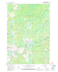
1965 Map of Crandon NE
USGS Topo · Published 1992About this map
The northern Wisconsin wilderness within Nicolet National Forest is defined here by a complex system of waterways and timberlands during the mid-1960s. The Peshtigo River snakes through the southern half of the quadrangle, joined by tributaries like Raymond Creek and Otter Creek, while the Popple River and Little Popple River drain the northern reaches. This landscape shows a distinct pattern of land use where forestry and conservation boundaries meet limited industrial and transit corridors.
Find a feature on this map
19 named features on this map. Tap any name to fly to it.
Don’t see what you’re looking for? This feature index may not catch every label — zoom into the map to look around manually.
Map Details
Editions of this 1965 Crandon NE Map
This is the sole edition of this map. No revisions or reprints were ever made.
Other maps of this area

1938 · Alvin
USGS Topo · 1:48,000

1939 · Crandon
USGS Topo · 1:48,000

1939 · Laona
USGS Topo · 1:48,000

1939 · Long Lake
USGS Topo · 1:48,000

1941 · Crandon
USGS Topo · 1:48,000

1946 · Laona
USGS Topo · 1:48,000

1946 · Alvin
USGS Topo · 1:48,000

1947 · Crandon
USGS Topo · 1:48,000

1948 · Long Lake
USGS Topo · 1:48,000

1954 · Iron Mountain
USGS Topo · 1:250,000