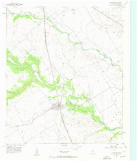
1957 Map of Crawford
USGS Topo · Published 1957About this map
Crawford serves as the central hub of this mid-century McLennan County landscape, situated where the Gulf Colorado and Santa Fe (AT & SF) railroad cuts across a complex network of waterways. The terrain is defined by the winding course of the Middle Bosque River and its numerous tributaries, including North Tonk Creek, Wasp Creek, and the prominent Hog Creek to the north. These drainage patterns influenced local land use, with gravel pits and quarries clustered near the riverbanks and creeks, highlighting the area's extractive economy.
Find a feature on this map
22 named features on this map. Tap any name to fly to it.
Don’t see what you’re looking for? This feature index may not catch every label — zoom into the map to look around manually.
Map Details
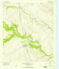
Editions of this 1957 Crawford Map
2 editions found
Other maps of this area

1888 · Meridian
USGS Topo · 1:125,000

1892 · Temple
USGS Topo · 1:125,000

1892 · Waco
USGS Topo · 1:125,000

1894 · Meridian
USGS Topo · 1:125,000

1894 · Gatesville
USGS Topo · 1:125,000

1920 · Waco
USGS Topo · 1:125,000

1924 · Waco 3-d
USGS Topo · 1:48,000

1931 · Valley Mills
USGS Topo · 1:62,500

1931 · Mc Gregor
USGS Topo · 1:62,500

1947 · Oglesby
USGS Topo · 1:24,000