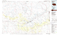
1986 Map of Crawford
USGS Topo · Published 1986About this map
Fort Robinson State Park and the expansive Nebraska National Forest anchor this mid-1980s portrait of the Pine Ridge region. The landscape is defined by its dramatic geological formations, with distinctive landmarks like Giants Coffins Butte, Lovers Leap Butte, and Sugar Loaf Butte rising above the plains. This era shows the critical junction of the Burlington Northern and Chicago and North Western railroads, which facilitated the movement of goods through the high plains. The map details the transition from the Oglala National Grassland in the north to the more settled areas of Crawford and Chadron, the latter being home to Chadron State College. Smaller, isolated outposts such as Orella, Story, and Belmont reflect the sparse, ranch-oriented settlement patterns that persisted in the Panhandle long after the frontier era.
Find a feature on this map
102 named features on this map. Tap any name to fly to it.
Don’t see what you’re looking for? This feature index may not catch every label — zoom into the map to look around manually.
Map Details
Editions of this 1986 Crawford Map
2 editions found
Other maps of this area

1896 · Oelrichs
USGS Topo · 1:125,000

1896 · Patrick
USGS Topo · 1:125,000

1899 · Whistle Creek
USGS Topo · 1:125,000

1900 · Oelrichs
USGS Topo · 1:125,000

1902 · Edgemont
USGS Topo · 1:125,000

1946 · Box Butte Reservoir West
USGS Topo · 1:24,000

1947 · Box Butte NW
USGS Topo · 1:24,000

1948 · Box Butte Reservoir West
USGS Topo · 1:24,000

1948 · Box Butte Reservoir East
USGS Topo · 1:24,000

1949 · Box Butte NW
USGS Topo · 1:24,000