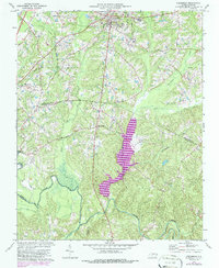
1974 Map of Creedmoor
USGS Topo · Published 1986About this map
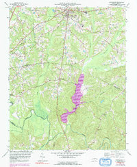
Creedmoor stands at the center of this 1974 survey, a period marked by significant hydrological changes as the Beaverdam Lake Rogers was being established along the Beaverdam Creek. The map documents the rural landscape of southern Granville County and northern Wake County before late 20th-century suburban expansion, showing a network of established communities like Northside and Sandy Plain. This era preserves the infrastructure of small-town life, from the South Granville Sch and Hawley Sch to numerous country churches including Union Ch, Olive Grove Ch, and Ledge Rock Ch. A significant portion of the Railroad is already noted as abandoned, indicating the shift in transport away from the tracks that once defined this corridor. The southern portion is dominated by the winding course of the Neuse River and its major tributaries, such as Ledge Creek and Smith Creek, illustrating the natural drainage patterns that shaped local settlement.
Find a feature on this map
29 named features on this map. Tap any name to fly to it.
Don’t see what you’re looking for? This feature index may not catch every label — zoom into the map to look around manually.
Map Details
Editions of this 1974 Creedmoor Map
6 editions found
Other maps of this area

1943 · Durham South
USGS Topo · 1:62,500

1943 · Raleigh
USGS Topo · 1:62,500

1943 · Creedmoor
USGS Topo · 1:62,500

1944 · Creedmoor
USGS Topo · 1:62,500

1951 · Raleigh
USGS Topo · 1:62,500

1951 · Durham South
USGS Topo · 1:62,500

1951 · Durham North
USGS Topo · 1:62,500

1953 · Raleigh
USGS Topo · 1:250,000

1953 · Greensboro
USGS Topo · 1:250,000

1954 · Greensboro
USGS Topo · 1:250,000