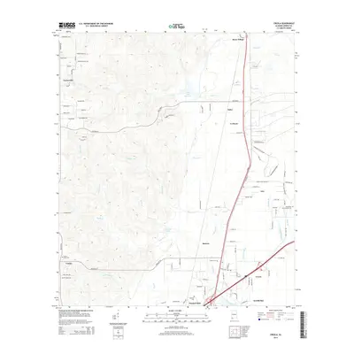
2014 Map of Creola
USGS Topo · Published 2014About this map
Creola and Satsuma anchor the southeastern corner of this landscape, situated near the intricate drainage of Gunnison Creek and Cypress Pond Br. The area is characterized by a transition from the elevated terrain near Turnerville and Celeste in the west toward the low-lying wetlands and tributaries of the Mobile River system to the east. The map records several long-standing community landmarks, including Forest Lawn Cem, Creola Cem, and Baldwin Cem, which provide significant points of interest for genealogical research in Mobile County. Industrial and utility footprints are evident via the Cold Creek Reservoir near Salco, while smaller settlements like Le Moyne, Axis, and Barry Village line the primary north-south transit corridor. Notable water features such as Dead Lake and Hatters Pond illustrate the complex hydrology that has historically shaped the development and local economy of these riverfront communities.
Find a feature on this map
98 named features on this map. Tap any name to fly to it.
Don’t see what you’re looking for? This feature index may not catch every label — zoom into the map to look around manually.
Map Details
Editions of this 2014 Creola Map
This is the sole edition of this map. No revisions or reprints were ever made.
Other maps of this area

1941 · Chickasaw
USGS Topo · 1:31,680

1941 · Bay Minette
USGS Topo · 1:62,500

1941 · Creola
USGS Topo · 1:62,500

1942 · Hurricane
USGS Topo · 1:31,680

1942 · Kushla
USGS Topo · 1:31,680
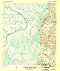
1943 · Hurricane
USGS Topo · 1:31,680

1943 · Creola
USGS Topo · 1:62,500

1943 · Chickasaw
USGS Topo · 1:31,680

1943 · Bay Minette
USGS Topo · 1:62,500

1943 · Tensaw
USGS Topo · 1:62,500