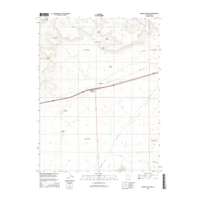
2014 Map of Crescent Junction
USGS Topo · Published 2014About this map
Crescent Junction serves as a critical transportation nexus in Grand County, where high-desert plains meet the dramatic rise of the Book Cliffs. The landscape is defined by its transit history and hydrological patterns, featuring the Old Cisco Hwy and Railroad Rd navigating the flatlands below Christmas Ridge. This 2014 survey reveals a rugged geography of washes and ridges, where the Crescent Wash Reservoir provides a rare point of collected water amidst the drainage of Crooked Wash and Thompson Wash. To the north, the terrain transitions into the steep relief of Crescent Canyon and Horse Heaven, while the southern portion of the quadrangle descends toward the unique geological formation of Salt Valley Gorge. Small settlements like Brendel remain centered on these arterial routes, illustrating the sparse but strategic human footprint in this arid environment.
Find a feature on this map
24 named features on this map. Tap any name to fly to it.
Don’t see what you’re looking for? This feature index may not catch every label — zoom into the map to look around manually.
Map Details
Editions of this 2014 Crescent Junction Map
This is the sole edition of this map. No revisions or reprints were ever made.
Other maps of this area

1885 · East Tavaputs
USGS Topo · 1:250,000

1885 · La Sal
USGS Topo · 1:250,000

1956 · Moab
USGS Topo · 1:250,000

1956 · Grand Junction
USGS Topo · 1:250,000

1958 · Crescent Junction
USGS Topo · 1:62,500

1958 · Thompson
USGS Topo · 1:62,500

1959 · Grand Junction
USGS Topo · 1:250,000

1959 · Moab
USGS Topo · 1:250,000

1960 · Moab
USGS Topo · 1:250,000

1960 · Grand Junction
USGS Topo · 1:250,000