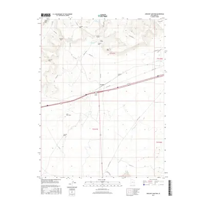
2017 Map of Crescent Junction
USGS Topo · Published 2017About this map
The high desert landscape of Grand County is dominated by the towering Book Cliffs and their southern benches. This 2017 survey shows the intersection of modern transit and older infrastructure at Crescent Junction and the railroad siding of Brendel. The terrain is deeply incised by drainages like Thompson Wash and Little Grand Wash, which define the movement of travelers through the area. Evocative place names like Horse Heaven and Christmas Ridge suggest the area's grazing and mineral history, while features like Copper Mine Ridge point toward local industry. Transport history is visible through the alignment of Old Hwy Cisco and the Railroad Rd, illustrating how early corridors shaped the modern path of Interstate 70 through this arid stretch of the Colorado Plateau.
Find a feature on this map
33 named features on this map. Tap any name to fly to it.
Don’t see what you’re looking for? This feature index may not catch every label — zoom into the map to look around manually.
Map Details
Editions of this 2017 Crescent Junction Map
This is the sole edition of this map. No revisions or reprints were ever made.
Other maps of this area

1885 · East Tavaputs
USGS Topo · 1:250,000

1885 · La Sal
USGS Topo · 1:250,000

1956 · Moab
USGS Topo · 1:250,000

1956 · Grand Junction
USGS Topo · 1:250,000

1958 · Crescent Junction
USGS Topo · 1:62,500

1958 · Thompson
USGS Topo · 1:62,500

1959 · Grand Junction
USGS Topo · 1:250,000

1959 · Moab
USGS Topo · 1:250,000

1960 · Moab
USGS Topo · 1:250,000

1960 · Grand Junction
USGS Topo · 1:250,000