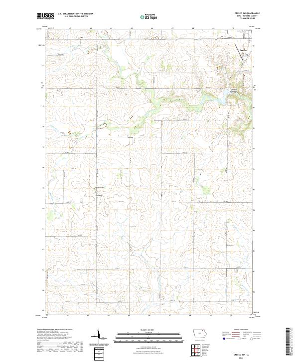
2022 Map of Cresco SW
USGS Topo · Published 2022About this map
Schley and the outskirts of Cresco anchor this Howard County landscape, where the headwaters of the Turkey River system branch across agricultural sections. The village of Schley sits at a crossroads in the township of t98n r12w, serving as a landmark near the Holy Cross Cem. To the northeast, Vernon Springs marks a historic point along the river, connected to larger population centers by the Prairie Springs Recreational Trl, which follows a former rail corridor. The drainage pattern is highly detailed, showing the convergence of the W Br Turkey River, N Br Turkey River, and Bohemian Cr. This topography highlights the transition from the upland plains to the river valleys, preserved in the local landmarks like Ellen Church Field near the northern edge of the survey.
Find a feature on this map
42 named features on this map. Tap any name to fly to it.
Don’t see what you’re looking for? This feature index may not catch every label — zoom into the map to look around manually.
Map Details
Editions of this 2022 Cresco SW Map
This is the sole edition of this map. No revisions or reprints were ever made.
Other maps of this area

1954 · Mason City
USGS Topo · 1:250,000

1957 · Mason City
USGS Topo · 1:250,000

1958 · Mason City
USGS Topo · 1:250,000

1972 · Jerico
USGS Topo · 1:24,000

1981 · Lourdes
USGS Topo · 1:24,000

1981 · Cresco NW
USGS Topo · 1:24,000
1981 · Cresco NE
USGS Topo · 1:24,000

1981 · Lime Springs
USGS Topo · 1:24,000
1981 · Saude
USGS Topo · 1:24,000
1981 · Cresco SE
USGS Topo · 1:24,000