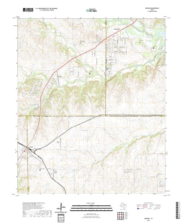
2022 Map of Cresson
USGS Topo · Published 2022About this map
The settlement of Cresson sits at the junction of three counties — Hood, Johnson, and Parker — serving as a central point for the surrounding ranchlands and prairie. To the north, the small community of Wheatland rests near the banks of the Clear Fork Trinity River, illustrating a long-standing settlement pattern along this vital waterway. The landscape is deeply marked by local family history, preserved through numerous burial grounds such as Keyes Cem, Corn Cem, and the Bear Creek / Reynolds Cem.
Find a feature on this map
90 named features on this map. Tap any name to fly to it.
Don’t see what you’re looking for? This feature index may not catch every label — zoom into the map to look around manually.
Map Details
Editions of this 2022 Cresson Map
This is the sole edition of this map. No revisions or reprints were ever made.
Other maps of this area

1889 · Granbury
USGS Topo · 1:125,000

1891 · Weatherford
USGS Topo · 1:125,000

1891 · Cleburne
USGS Topo · 1:125,000

1893 · Weatherford
USGS Topo · 1:125,000

1894 · Cleburne
USGS Topo · 1:125,000

1894 · Fort Worth
USGS Topo · 1:125,000

1923 · Granbury 1-b
USGS Topo · 1:48,000

1928 · Godley
USGS Topo · 1:62,500

1954 · Dallas
USGS Topo · 1:250,000

1955 · Aledo
USGS Topo · 1:24,000