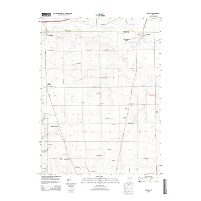
2013 Map of Creston
USGS Topo · Published 2013About this map
Creston and the village of Burbank anchor the northern landscape of this 2013 survey, where the administrative boundary between Medina County and Wayne County bisects a region of meticulously plotted agricultural tracts. The map details an extensive array of named homesteads, including McLaughlin Farms, Hoistington Farms, and Moonstruck Farm, which coexist alongside numerous local burial grounds such as Maple Mound Cem, Canaan Cem, and Shoemaker Cem. The natural drainage of the land is defined by the course of Killbuck Creek, while the presence of the Wayne County Airport provides a significant infrastructure marker for the era. In settlements like West Canaan and Golden Corners, the proximity of cemeteries to established farmsteads suggests a persistent continuity of land ownership. This intersection of transport routes like Wooster Pike and Cleveland Rd with long-held family lands reveals the enduring rural character of this Ohio corridor.
Find a feature on this map
90 named features on this map. Tap any name to fly to it.
Don’t see what you’re looking for? This feature index may not catch every label — zoom into the map to look around manually.
Map Details
Editions of this 2013 Creston Map
This is the sole edition of this map. No revisions or reprints were ever made.
Other maps of this area

1901 · Wooster
USGS Topo · 1:62,500

1903 · Wooster
USGS Topo · 1:62,500

1904 · Medina
USGS Topo · 1:62,500

1904 · Wellington
USGS Topo · 1:62,500

1906 · Medina
USGS Topo · 1:62,500

1906 · Wellington
USGS Topo · 1:62,500

1906 · West Salem
USGS Topo · 1:62,500

1908 · West Salem
USGS Topo · 1:62,500

1950 · Cleveland
USGS Topo · 1:250,000

1950 · Marion
USGS Topo · 1:250,000