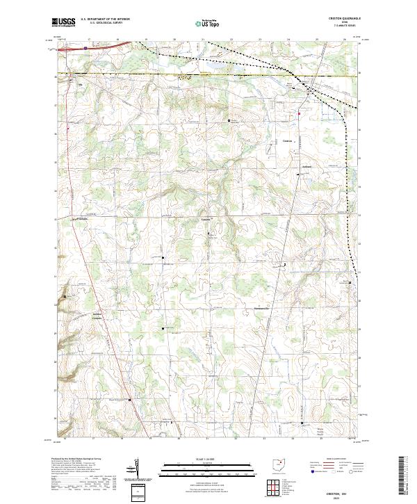
2023 Map of Creston
USGS Topo · Published 2023About this map
Creston and its surrounding rural townships sit at the border of Medina and Wayne counties, a landscape defined by traditional agricultural patterns and a dense network of country roads. The village of Creston serves as a primary hub, while smaller named crossroads like Canaan, Jackson, and Hermanville suggest the historical settlement density of this region. The terrain is marked by the meandering paths of Killbuck Creek and its tributary, Killbuck Ditch, which drain the low-lying fields.
Find a feature on this map
85 named features on this map. Tap any name to fly to it.
Don’t see what you’re looking for? This feature index may not catch every label — zoom into the map to look around manually.
Map Details
Editions of this 2023 Creston Map
This is the sole edition of this map. No revisions or reprints were ever made.
Other maps of this area

1901 · Wooster
USGS Topo · 1:62,500

1903 · Wooster
USGS Topo · 1:62,500

1904 · Medina
USGS Topo · 1:62,500

1904 · Wellington
USGS Topo · 1:62,500

1906 · Medina
USGS Topo · 1:62,500

1906 · Wellington
USGS Topo · 1:62,500

1906 · West Salem
USGS Topo · 1:62,500

1908 · West Salem
USGS Topo · 1:62,500

1950 · Cleveland
USGS Topo · 1:250,000

1950 · Marion
USGS Topo · 1:250,000