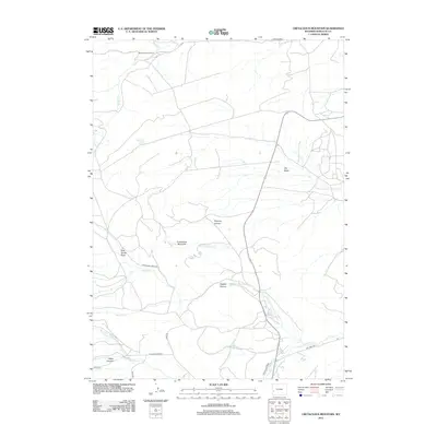
2012 Map of Cretaceous Mountain
USGS Topo · Published 2012About this map
Mountain Home Ranch and its associated Mountain Home Spring sit in the northern reaches of this high-altitude landscape in western Wyoming. The terrain is defined by a series of deep drainages and canyons, most notably Deloney Canyon and Fogarty Canyon, which carve through the slopes around Cretaceous Mountain. These natural corridors dictate the path of the region's historical ranch roads and trails, such as Pine Grove Creek Rd and Janis Rd.
Find a feature on this map
25 named features on this map. Tap any name to fly to it.
Don’t see what you’re looking for? This feature index may not catch every label — zoom into the map to look around manually.
Map Details
Editions of this 2012 Cretaceous Mountain Map
This is the sole edition of this map. No revisions or reprints were ever made.
Other maps of this area

1939 · Big Piney
USGS Topo · 1:125,000

1942 · Big Piney
USGS Topo · 1:125,000

1955 · Preston
USGS Topo · 1:250,000

1958 · Preston
USGS Topo · 1:250,000

1962 · Preston
USGS Topo · 1:250,000

1969 · Chimney Butte
USGS Topo · 1:24,000

1969 · La Barge
USGS Topo · 1:24,000

1969 · Cretaceous Mountain
USGS Topo · 1:24,000
1969 · The Hogsback
USGS Topo · 1:24,000
1969 · Pine Grove Ridge
USGS Topo · 1:24,000