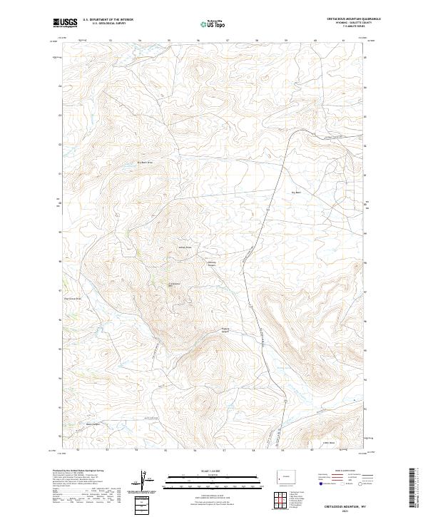
2021 Map of Cretaceous Mountain
USGS Topo · Published 2021About this map
Cretaceous Mtn rises as a central landmark in this high-desert landscape of Sublette County, where intricate drainage patterns define the topography. The terrain is marked by a series of named draws and canyons, including Lackey Draw, Deloney Canyon, and Fogarty Canyon, which carve through the dry uplands. A vital network of water sources, such as Mountain Home Spring and Tip Top Spring, suggests the importance of reliable water in this arid environment, likely supporting livestock or local wildlife. The area is intersected by several essential transportation routes, most notably the Big Piney Calpet Rd, which facilitates movement across the Dry Basin. To the south, Little Mesa and the depths of Black Canyon further characterize the varied elevation of this Wyoming territory.
Find a feature on this map
30 named features on this map. Tap any name to fly to it.
Don’t see what you’re looking for? This feature index may not catch every label — zoom into the map to look around manually.
Map Details
Editions of this 2021 Cretaceous Mountain Map
This is the sole edition of this map. No revisions or reprints were ever made.
Other maps of this area

1939 · Big Piney
USGS Topo · 1:125,000

1942 · Big Piney
USGS Topo · 1:125,000

1955 · Preston
USGS Topo · 1:250,000

1958 · Preston
USGS Topo · 1:250,000

1962 · Preston
USGS Topo · 1:250,000

1969 · Chimney Butte
USGS Topo · 1:24,000

1969 · La Barge
USGS Topo · 1:24,000

1969 · Cretaceous Mountain
USGS Topo · 1:24,000
1969 · The Hogsback
USGS Topo · 1:24,000
1969 · Pine Grove Ridge
USGS Topo · 1:24,000