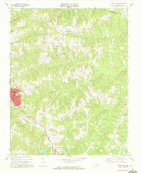
1968 Map of Crewe East
USGS Topo · Published 1972About this map
The town of Crewe and the nearby settlement of Fergusonville anchor this late 1960s study of Nottoway and Amelia Counties. The Norfolk and Western railroad corridor serves as the primary industrial axis, flanked by landmarks such as the Crewe Municipal Airport and the Southside Vocational Sch. The landscape is defined by the drainage systems of Deep Creek and the Little Nottoway River, which carve through a terrain dotted with numerous small country churches and rural burial grounds.
Find a feature on this map
37 named features on this map. Tap any name to fly to it.
Don’t see what you’re looking for? This feature index may not catch every label — zoom into the map to look around manually.
Map Details
Editions of this 1968 Crewe East Map
4 editions found
Other maps of this area

1891 · Farmville
USGS Topo · 1:125,000

1893 · Farmville
USGS Topo · 1:125,000

1897 · Amelia
USGS Topo · 1:125,000

1943 · Amelia
USGS Topo · 1:31,680

1943 · Richmond
USGS Topo · 1:250,000

1947 · Roanoke
USGS Topo · 1:250,000

1949 · Richmond
USGS Topo · 1:250,000
1950 · Wellville
USGS Topo · 1:24,000

1958 · Jetersville
USGS Topo · 1:62,500

1958 · Crewe
USGS Topo · 1:62,500