
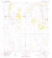
1953 Map of Crewsville SE
USGS Topo · Published 1954About this map
The low-lying wetlands of South-Central Florida dominate this 1953 landscape, defined by a complex network of seasonal water and swamp. Oak Creek Marsh and Niggertown Marsh characterize the hydrologic pattern, where subtle elevation changes create distinct terrain features like Niggertown Knoll and the wooded Hog Island Hammock. These island-like rises in the marsh provided rare dry ground for local activity and landmarks in an otherwise fluid environment.
Find a feature on this map
13 named features on this map. Tap any name to fly to it.
Don’t see what you’re looking for? This feature index may not catch every label — zoom into the map to look around manually.
Map Details
Editions of this 1953 Crewsville SE Map
4 editions found
Other maps of this area

1952 · Sebring
USGS Topo · 1:24,000

1953 · Lake June In Winter
USGS Topo · 1:24,000

1953 · Venus NW
USGS Topo · 1:24,000

1953 · Crewsville
USGS Topo · 1:24,000

1956 · Sweetwater
USGS Topo · 1:24,000

1956 · Crewsville SW
USGS Topo · 1:24,000

1956 · Fort Pierce
USGS Topo · 1:250,000

1957 · Long Island Marsh NW
USGS Topo · 1:24,000

1957 · Long Island Marsh NE
USGS Topo · 1:24,000

1958 · Fort Pierce
USGS Topo · 1:250,000