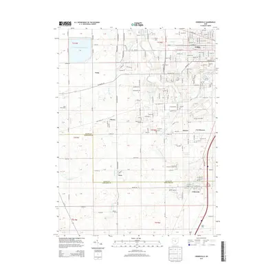
2013 Map of Cridersville
USGS Topo · Published 2013About this map
Bresler Upground Reservoir dominates the northwestern corner of this study, a massive geometric basin that contrasts with the natural winding courses of the Ottawa River and Little Ottawa River to the east. This section of the Allen and Auglaize County border shows a landscape transitioning from the urban southern edges of Lima and the community of Fort Shawnee into the agricultural south. Small hamlets like Hume, Kemp, and Oakview are dispersed among a grid of rural roads, including W Wapakoneta Rd and Fort Amanda Rd.
Find a feature on this map
191 named features on this map. Tap any name to fly to it.
Don’t see what you’re looking for? This feature index may not catch every label — zoom into the map to look around manually.
Map Details
Editions of this 2013 Cridersville Map
This is the sole edition of this map. No revisions or reprints were ever made.
Other maps of this area

1906 · Lima
USGS Topo · 1:62,500

1906 · Columbus Grove
USGS Topo · 1:62,500

1908 · Columbus Grove
USGS Topo · 1:62,500

1911 · Spencerville
USGS Topo · 1:62,500

1911 · Delphos
USGS Topo · 1:62,500

1944 · Delphos
USGS Topo · 1:62,500

1944 · Spencerville
USGS Topo · 1:62,500

1953 · Muncie
USGS Topo · 1:250,000

1956 · Muncie
USGS Topo · 1:250,000
1960 · Delphos
USGS Topo · 1:24,000