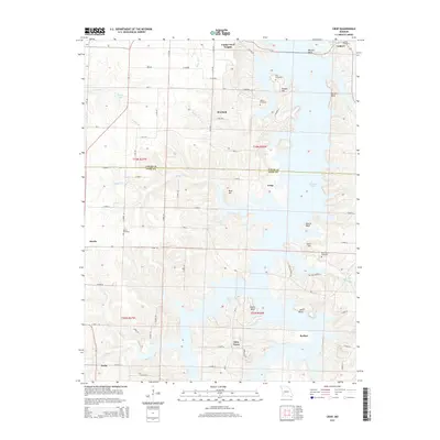
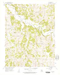
2015 Map of Crisp
USGS Topo · Published 2015About this map
Stockton Lake dominates the eastern half of this modern topographical survey, its intricate shoreline creating numerous bluffs and points that define the local geography. Small settlements and rural hubs like Crisp, Arcola, and Seybert are scattered across the landscape, connected by a network of county roads such as Mo-H and E Highway H. The terrain is marked by a series of prominent bluffs and hills overlooking the water, including Wasson Bluff, Sorters Bluff, and Ruark Bluff. For those tracing local history or family lineage, the map identifies several established burial grounds like Gordon Cemetery, Liberty Cemetery, and Bald Mound Cemetery. The boundary between Cedar and Dade Counties cuts across the center, where the drainage from Googer Cr and Mutton Cr feeds into the reservoir. This 2015 study provides a clear view of the rural residential patterns at Umber View Heights and Glen Town as they interface with the managed lake environment.
Find a feature on this map
74 named features on this map. Tap any name to fly to it.
Don’t see what you’re looking for? This feature index may not catch every label — zoom into the map to look around manually.
Map Details
Editions of this 2015 Crisp Map
This is the sole edition of this map. No revisions or reprints were ever made.
Other maps of this area

1886 · Stockton
USGS Topo · 1:125,000

1886 · Greenfield
USGS Topo · 1:125,000

1888 · Greenfield
USGS Topo · 1:125,000

1954 · Springfield
USGS Topo · 1:250,000

1955 · Dadeville
USGS Topo · 1:24,000
1956 · Stockton
USGS Topo · 1:24,000
1956 · Bearcreek
USGS Topo · 1:24,000

1956 · Greenfield
USGS Topo · 1:24,000
1956 · Lockwood
USGS Topo · 1:24,000
1956 · Bona
USGS Topo · 1:24,000