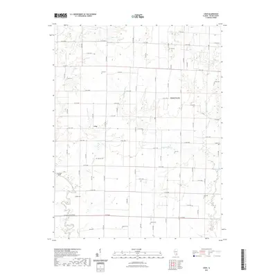
2021 Map of Crisp
USGS Topo · Published 2021About this map
Skillet Fork and its various tributaries define the low-lying drainage of western Wayne County, where the small community of Crisp serves as a central reference point in this rural Illinois landscape. The terrain transitions from the watercourses of Little Dry Fork and Miller Cr toward localized elevations like Linder Hill, illustrating the typical prairie and creek-bottom topography of the region.
Find a feature on this map
45 named features on this map. Tap any name to fly to it.
Don’t see what you’re looking for? This feature index may not catch every label — zoom into the map to look around manually.
Map Details
Editions of this 2021 Crisp Map
This is the sole edition of this map. No revisions or reprints were ever made.
Other maps of this area

1947 · Wayne City
USGS Topo · 1:62,500

1948 · Fairfield
USGS Topo · 1:62,500

1948 · Flora
USGS Topo · 1:62,500

1949 · Flora
USGS Topo · 1:62,500

1952 · Xenia
USGS Topo · 1:62,500

1958 · Belleville
USGS Topo · 1:250,000

1962 · Belleville
USGS Topo · 1:250,000
1968 · Orchardville
USGS Topo · 1:24,000
1968 · Johnsonville
USGS Topo · 1:24,000
1970 · Cisne
USGS Topo · 1:24,000