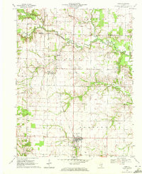
1970 Map of Cisne
USGS Topo · Published 1972About this map
Cisne stands as the primary hub of this southern Illinois landscape during the early 1970s, situated at the intersection of the Baltimore and Ohio railroad and local county roads. The map reveals a land defined by the subsurface wealth of the Clay City Oil Field and the Rinard North Oil Field, with derrick locations and service roads punctuating the rural sections. This industrial layer exists alongside a deeply rooted agricultural community, evidenced by numerous small cemeteries such as Stine Cem, Pratt Cem, and Madden Cem, which mark the homesteads of early settlers.
Find a feature on this map
29 named features on this map. Tap any name to fly to it.
Don’t see what you’re looking for? This feature index may not catch every label — zoom into the map to look around manually.
Map Details
Editions of this 1970 Cisne Map
This is the sole edition of this map. No revisions or reprints were ever made.
Other maps of this area

1947 · Wayne City
USGS Topo · 1:62,500

1948 · Fairfield
USGS Topo · 1:62,500

1948 · Flora
USGS Topo · 1:62,500

1949 · Flora
USGS Topo · 1:62,500

1952 · Xenia
USGS Topo · 1:62,500

1958 · Belleville
USGS Topo · 1:250,000

1962 · Belleville
USGS Topo · 1:250,000
1968 · Xenia NE
USGS Topo · 1:24,000
1968 · Johnsonville
USGS Topo · 1:24,000

1970 · Clay City
USGS Topo · 1:24,000