1926 Map of Critz
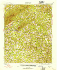
USGS Topo · Published 1953About this map
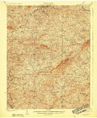
Bull Mountain and No Business Mountain dominate the skyline of Patrick and Henry Counties in this mid-1920s survey of the Virginia and North Carolina borderlands. The rural economy of the era is anchored by the Danville and Western Ry, which snakes through the center of the sheet to serve the settlement at Critz. Local life is recorded through a high density of community landmarks, including numerous rural schools like Blue Ridge Mission Sch and Race Track Sch, alongside multiple post offices such as Patrick Springs Sta and P O.
Find a feature on this map
179 named features on this map. Tap any name to fly to it.
Don’t see what you’re looking for? This feature index may not catch every label — zoom into the map to look around manually.
Map Details
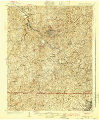
Editions of this 1926 Critz Map
2 editions found
Other maps of this area

1924 · Martinsville
USGS Topo · 1:48,000

1925 · Rocky Mount
USGS Topo · 1:48,000

1926 · Martinsville
USGS Topo · 1:62,500

1926 · Critz
USGS Topo · 1:48,000
1927 · Rocky Mount
USGS Topo · 1:62,500
1927 · Martinsville
USGS Topo · 1:62,500

1928 · Stuart
USGS Topo · 1:48,000

1928 · Critz
USGS Topo · 1:62,500

1931 · Stuart
USGS Topo · 1:62,500

1944 · Martinsville
USGS Topo · 1:62,500