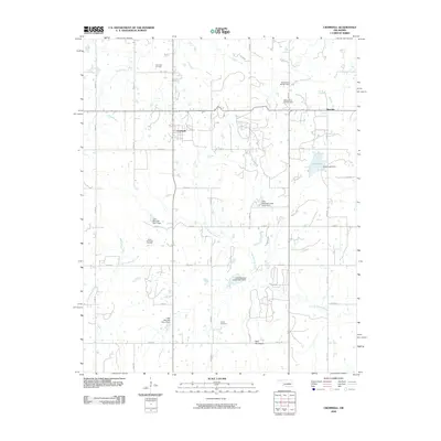
2009 Map of Cromwell
USGS Topo · Published 2009About this map
The Cromwell Oil Field and South Cromwell Oil Field define the economic and industrial character of this Seminole County landscape. Centered on the town of Cromwell, the area is marked by a complex network of section-line roads such as ns367 RD and ew116 RD, which navigate a terrain of low ridges and small drainages. The local hydrography is heavily managed, featuring numerous conservation structures including the Little Wewoka Creek Site 6 Dam and Little Wewoka Site 1 Dam, which regulate the flow of the Little Wewoka Creek. To the east, the settlement of Bearden sits near Cohee Lake, while the southern portion of the quadrangle is anchored by the prominent Bald Mountain and the Butner Cemetery. This survey illustrates the integration of petroleum extraction with rural Oklahoma agricultural infrastructure in the early 21st century.
Find a feature on this map
35 named features on this map. Tap any name to fly to it.
Don’t see what you’re looking for? This feature index may not catch every label — zoom into the map to look around manually.
Map Details
Editions of this 2009 Cromwell Map
This is the sole edition of this map. No revisions or reprints were ever made.
Other maps of this area

1896 · Seminole and Prague
USGS Topo · 1:125,000

1900 · Wewoka
USGS Topo · 1:125,000

1954 · Oklahoma City
USGS Topo · 1:250,000

1957 · Oklahoma City
USGS Topo · 1:250,000

1963 · Oklahoma City
USGS Topo · 1:250,000

1967 · Cromwell
USGS Topo · 1:24,000

1967 · Prague NE
USGS Topo · 1:24,000

1967 · Okemah SE
USGS Topo · 1:24,000

1967 · Okemah
USGS Topo · 1:24,000

1967 · Prague SE
USGS Topo · 1:24,000