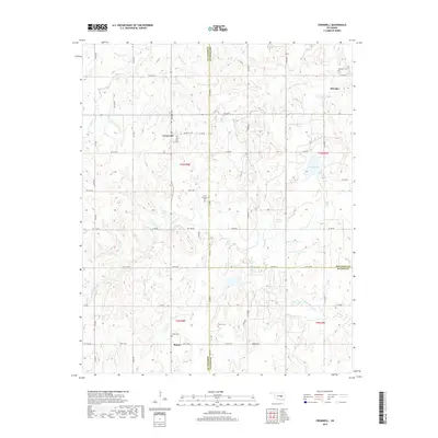
2018 Map of Cromwell
USGS Topo · Published 2018About this map
Cromwell and its surrounding rural landscapes in Seminole County are documented in this 2018 survey, which highlights the intersection of local history and Oklahoma's sectional geography. The map serves as a detailed record of the borderlands where Seminole, Okfuskee, and Hughes Counties meet. Significant local sites include Bearden Cem in the northeast and Butner Cem further south, providing essential markers for genealogical research in these small communities. The terrain is defined by the winding course of Little Wewoka Cr and the presence of Bald Mtn, which rises above the agricultural and oil-field access roads like Shawnee Ave. From the waters of Cohee Lake to the scattered settlements of Bearden and Butner, this sheet preserves the modern footprint of a region deeply tied to its territorial past and rural infrastructure.
Find a feature on this map
51 named features on this map. Tap any name to fly to it.
Don’t see what you’re looking for? This feature index may not catch every label — zoom into the map to look around manually.
Map Details
Editions of this 2018 Cromwell Map
This is the sole edition of this map. No revisions or reprints were ever made.
Other maps of this area

1896 · Seminole and Prague
USGS Topo · 1:125,000

1900 · Wewoka
USGS Topo · 1:125,000

1954 · Oklahoma City
USGS Topo · 1:250,000

1957 · Oklahoma City
USGS Topo · 1:250,000

1963 · Oklahoma City
USGS Topo · 1:250,000

1967 · Cromwell
USGS Topo · 1:24,000

1967 · Prague NE
USGS Topo · 1:24,000

1967 · Okemah SE
USGS Topo · 1:24,000

1967 · Okemah
USGS Topo · 1:24,000

1967 · Prague SE
USGS Topo · 1:24,000